


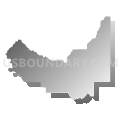
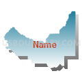
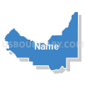
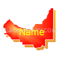
Grant & Kittitas Counties PUMA, Washington
About
Outline

Summary
| Unique Area Identifier | 194329 |
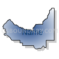
| Name | Grant & Kittitas Counties PUMA |
| State | Washington |
| Area (square miles) | 5,124.25 |
| Land Area (square miles) | 4,976.78 |
| Water Area (square miles) | 147.47 |
| % of Land Area | 97.12 |
| % of Water Area | 2.88 |
| Latitude of the Internal Point | 47.17633960 |
| Longtitude of the Internal Point | -120.01223730 |
Maps


Graphs
Select a template below for downloading or customizing gragh for Grant & Kittitas Counties PUMA, Washington


Neighbors
Neighoring Public Use Microdata Area (by Name) Neighboring Public Use Microdata Area on the Map
- Chelan & Douglas Counties PUMA, WA
- King County (Northeast)--Snoqualmie City, Cottage Lake, Union Hill & Novelty Hill PUMA, WA
- King County (Southeast)--Maple Valley, Covington & Enumclaw Cities PUMA, WA
- Pierce County (Southeast)--Graham, Elk Plain & Prairie Ridge PUMA, WA
- Stevens, Okanogan, Pend Oreille & Ferry Counties PUMA, WA
- Walla Walla, Benton (Outer) & Franklin (Outer) Counties PUMA, WA
- Whitman, Asotin, Adams, Lincoln, Columbia & Garfield Counties PUMA, WA
- Yakima County (Outer)--Sunnyside & Grandview Cities PUMA, WA
Top 10 Neighboring County (by Population) Neighboring County on the Map
- King County, WA (1,931,249)
- Pierce County, WA (795,225)
- Yakima County, WA (243,231)
- Benton County, WA (175,177)
- Grant County, WA (89,120)
- Franklin County, WA (78,163)
- Chelan County, WA (72,453)
- Okanogan County, WA (41,120)
- Kittitas County, WA (40,915)
- Douglas County, WA (38,431)
Top 10 Neighboring County Subdivision (by Population) Neighboring County Subdivision on the Map
- Enumclaw Plateau CCD, King County, WA (63,367)
- Snoqualmie Valley CCD, King County, WA (48,362)
- Moses Lake CCD, Grant County, WA (34,043)
- East Wenatchee CCD, Douglas County, WA (29,708)
- Ellensburg CCD, Kittitas County, WA (20,724)
- Ephrata-Soap Lake CCD, Grant County, WA (17,100)
- Mattawa-Royal City CCD, Grant County, WA (14,870)
- Othello CCD, Adams County, WA (14,543)
- Northwest Benton CCD, Benton County, WA (13,622)
- Cashmere CCD, Chelan County, WA (10,895)
Top 10 Neighboring Place (by Population) Neighboring Place on the Map
- Moses Lake city, WA (20,366)
- Ellensburg city, WA (18,174)
- Ephrata city, WA (7,664)
- Quincy city, WA (6,750)
- Mattawa town, WA (4,437)
- Moses Lake North CDP, WA (4,418)
- Warden city, WA (2,692)
- Cascade Valley CDP, WA (2,246)
- Royal City city, WA (2,140)
- Cle Elum city, WA (1,872)
Top 10 Neighboring Unified School District (by Population) Neighboring Unified School District on the Map
- Richland School District, WA (62,323)
- Wenatchee School District, WA (42,698)
- Moses Lake School District, WA (39,664)
- Snoqualmie Valley School District, WA (35,054)
- Ellensburg School District, WA (26,508)
- Enumclaw School District, WA (25,179)
- White River School District, WA (22,116)
- Selah School District, WA (18,675)
- Othello School District, WA (14,916)
- Quincy School District, WA (11,750)
Top 10 Neighboring State Legislative District Lower Chamber (by Population) Neighboring State Legislative District Lower Chamber on the Map
- State House District 5, WA (161,403)
- State House District 8, WA (149,474)
- State House District 13, WA (143,750)
- State House District 39, WA (143,154)
- State House District 31, WA (137,685)
- State House District 9, WA (136,166)
- State House District 12, WA (132,531)
- State House District 14, WA (130,478)
- State House District 7, WA (130,475)
Top 10 Neighboring State Legislative District Upper Chamber (by Population) Neighboring State Legislative District Upper Chamber on the Map
- State Senate District 5, WA (161,403)
- State Senate District 8, WA (149,474)
- State Senate District 13, WA (143,750)
- State Senate District 39, WA (143,154)
- State Senate District 31, WA (137,685)
- State Senate District 9, WA (136,166)
- State Senate District 12, WA (132,531)
- State Senate District 14, WA (130,478)
- State Senate District 7, WA (130,475)
Top 10 Neighboring 111th Congressional District (by Population) Neighboring 111th Congressional District on the Map
- Congressional District 8, WA (810,754)
- Congressional District 4, WA (774,409)
- Congressional District 2, WA (760,041)
- Congressional District 5, WA (723,609)
Top 10 Neighboring Census Tract (by Population) Neighboring Census Tract on the Map
- Census Tract 114.02, Grant County, WA (13,025)
- Census Tract 110, Grant County, WA (11,087)
- Census Tract 109.02, Grant County, WA (9,912)
- Census Tract 208, Franklin County, WA (8,296)
- Census Tract 104, Grant County, WA (8,040)
- Census Tract 9754.01, Kittitas County, WA (7,501)
- Census Tract 111, Grant County, WA (7,029)
- Census Tract 9503, Adams County, WA (6,934)
- Census Tract 106, Grant County, WA (6,848)
- Census Tract 9605, Chelan County, WA (6,831)
Top 10 Neighboring 5-Digit ZIP Code Tabulation Area (by Population) Neighboring 5-Digit ZIP Code Tabulation Area on the Map
- 98801, WA (40,977)
- 98837, WA (39,722)
- 98926, WA (30,239)
- 98901, WA (30,169)
- 98944, WA (22,014)
- 98022, WA (20,987)
- 98942, WA (16,973)
- 99344, WA (16,817)
- 98045, WA (13,888)
- 98848, WA (11,518)